
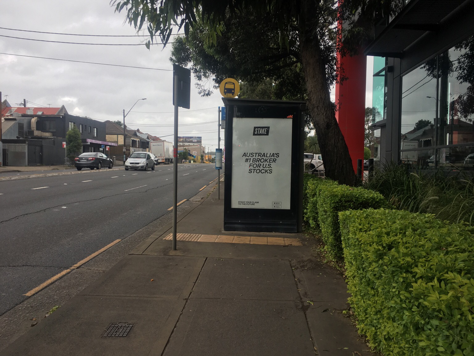
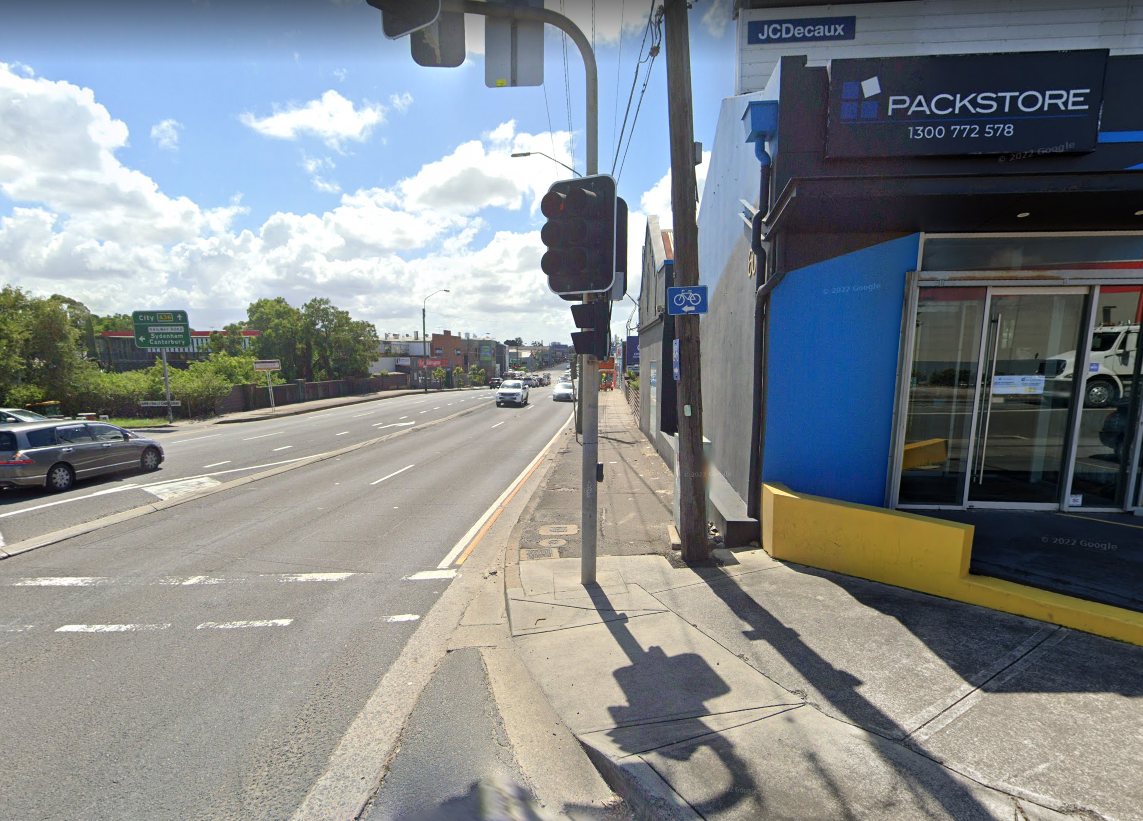
A classic Sydney ‘shared path’ (legalised footpath) and excessive advertising combo. If it were glass you could at least see if anyone was waiting at the bus shelter or riding the other way, as it is you have to ride at walking speed to negotiate this. (The road is 70km/hr death.)
The problem is not so much that these shared paths exist - I’d rather ride them than nothing - but that they’re counted in our kms of cycling infrastructure.
@jakecoppinger Princes Highway southbound (between Sydney Park and Ikea). Not one of the City of Sydney ones.

@jroper Ah yes - I know how frustrating that stroad is.
I see it’s on OSM as a shared path but from street imagery it may not be. I’m 100% sure at one point of the footpath it’s marked as bikes allowed but maybe the entire path isn’t - I’ll investigate.
@jakecoppinger huh yeah you might be right, on the TfNSW cycleway finder this part isn't shared path at all. Only further south. Good thing it doesn't seem to be enforced as it's quite popular with delivery riders around Hungry Jacks.
@jroper I checked the Mapillary imagery and I'm quite sure it's legally a footpath, not a shared path - please let me know if you come across markings to suggest otherwise!
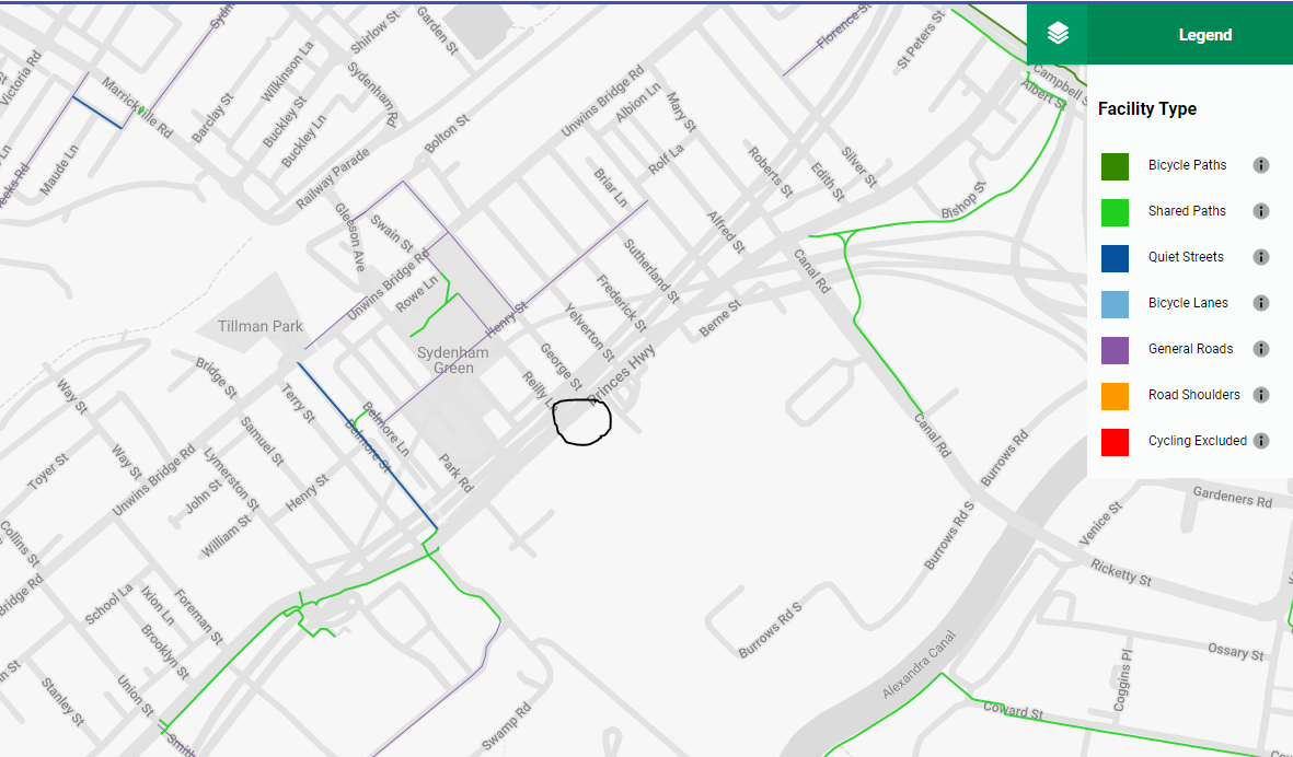
I updated OSM so those changes will flow through to maps & routing apps in the coming days: https://www.openstreetmap.org/changeset/133069550#map=17/-33.91882/151.17432
The path on Canal Rd was also misaligned and wrongly tagged: https://www.openstreetmap.org/changeset/133069732
I think Henry St is the closest "designated" east-west route, 50kmh limit though a laneway with a low traffic volume from memory. The connection between it and the St Peters path is non-existent though.
The area could definitely do with a resurvey with new Mapillary or drone imagery to make sure what is there. I'll try to get to it at some point but maybe someone will beat me!
#openstreetmap #mapillary #sydney #nsw #cycling #maps #urbanism #betterstreets #tempe
@jakecoppinger Wow, nearly all the previous changes are yours too. I don't realise how few people are doing all the work.
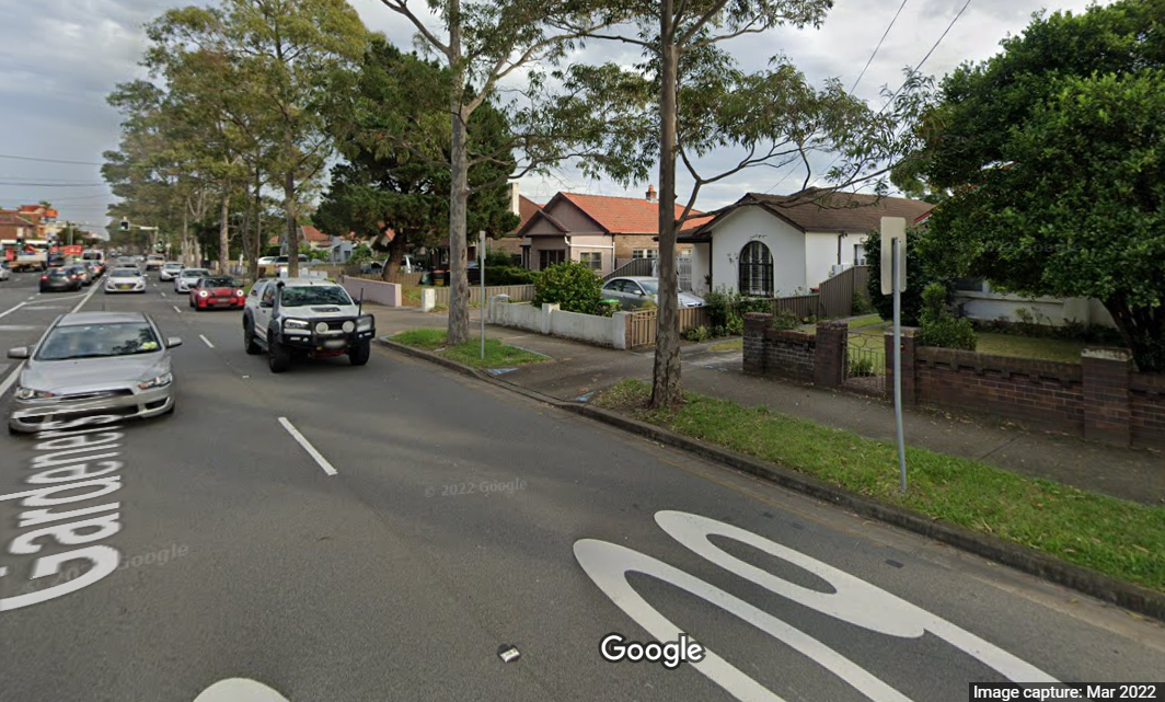
I think it's right now. As far as signage, I found this little sign at the south end on google. From the north (from the new path through the park) there is no signage or markings either way that I can find.

@jroper I'm so sick of people who ride bikes being given less priority than waste of resources death machines. And councils/governments wonder why people don't take up bike riding for transport
@jroper and it could have been on that land used by the hedge
@jroper Frm your picture, it looks like a simple regular sidewalk for pedestrians and not for cyclists.
@jfmezei Indeed, probably needs some explanation for people overseas. In NSW, cyclists are prohibited from sidewalks (unless with children), and the network of safe cycling routes is very sparse. Some local councils try to alleviate the situation by labeling some sidewalks as 'shared paths'.
Here's another one, part of a route to my uni - in this case there's some blue paint indicating shared path status but it's otherwise indistinguishable from a regular sidewalk.

@jroper @CathyTuttle Cathy, I thought you would find this interesting.
@kith @jroper What a deadly design! Yes, that bus shelter right in the middle of a "shared use path" right next to a high speed road would require anyone riding a bike to get off and creep around it.
I worry even more about people using mobility devices, pushing strollers, and even getting on and off the bus. The photo seems to show less than 30" (75cm) of clear space. Illegal in many places.
@CathyTuttle @kith So it turns out I was wrong, as Jake pointed out earlier. This part is not actually a legal shared path, just frequently used as such owing to being in between two sections of shared path - see pic - with a lack of signage differentiating them.
So the issue is more the absence of clarity and missing links of our cycling routes.
@jroper There is so much wrong with the picture. People catching the bus deserver shelter from wind, rain or sun---just a pity it cannot shelter from vehicle pollution & noise. Zero protection if a vehicle runs onto the pavement, but don't worry, the car passengers have seat belts and airbags. Should we have 50km zones around bus stops/bus routes?
From the cyclist's viewpoint, poorly placed signage poles and zero visibility—with ads aimed at car drivers.

@jroper Where abouts is this stop?