Is Your Town a Parking Lot?
Find out how much of your neighborhood is dedicated to parked cars.
https://googlemapsmania.blogspot.com/2023/03/is-your-town-parking-lot.html

@mapsmania
You can try this out for your city.
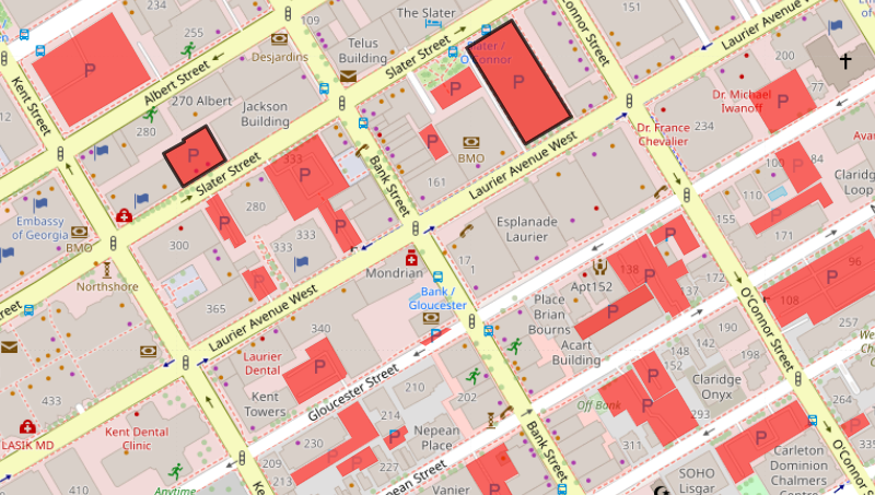
Here’s downtown Ottawa. Red indicates areas taken up by parking, according to https://googlemapsmania.blogspot.com/2023/03/is-your-town-parking-lot.html
#Ottawa #OttBike #Cars

@johnefrancis @jd @mapsmania The Ottawa map above appears to have been generated with the Overpass Turbo tool. This queries OpenStreetMap and returns parking as a point or a polygon depending what's in OSM.
The 50 cities in the linked report had additional manual analysis done to get more accurate maps - "manually added all parking based on Google Maps satellite imagery." (https://parkingreform.org/resources/parking-lot-map/)
@mapsmania @johnefrancis @jd Oh yeah you're right, I assumed there were node results because it says nodes at the bottom right, but that's just the nodes on the ways; the query only returns ways.