
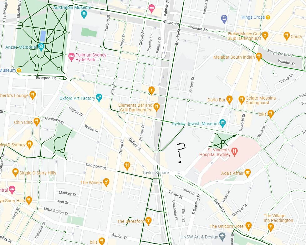
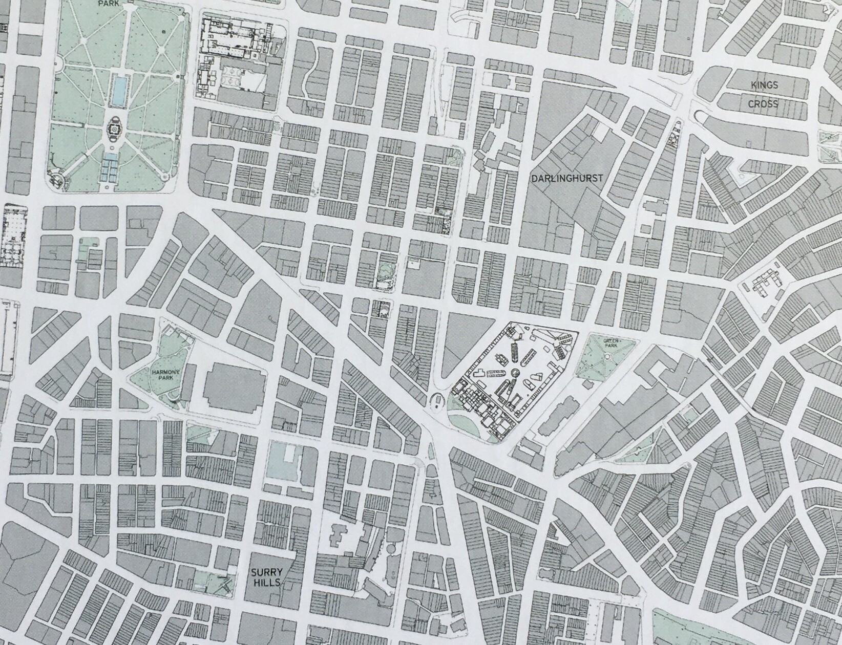
Darlinghurst mapped: Google vs Public Sydney
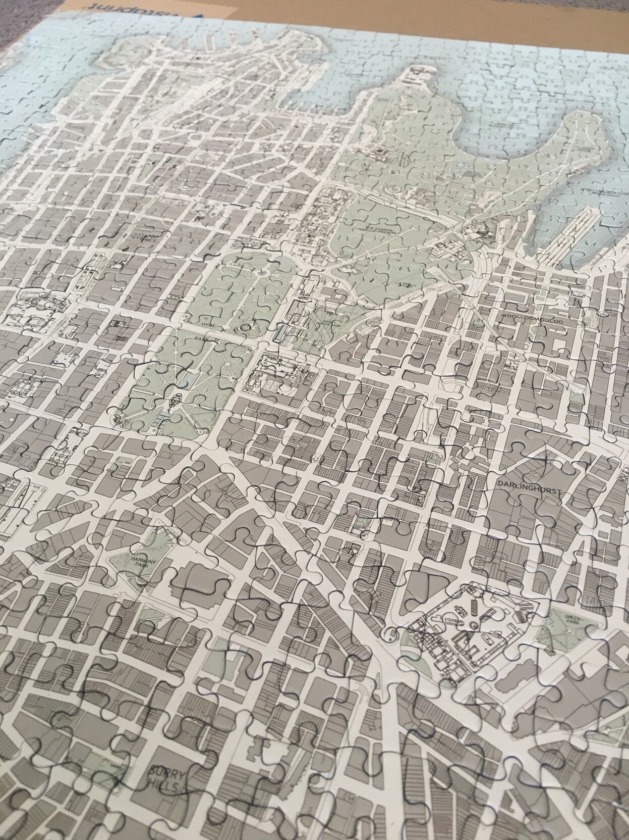
Spent a few too many hours since Christmas doing my Public Sydney puzzle the slow way - without looking at the picture or other maps to help!
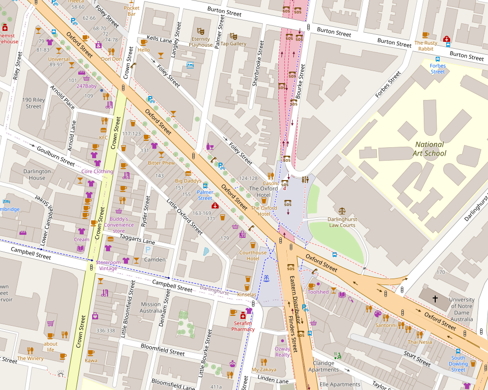
The complex in the middle here puzzled me - I had no idea what or where it was. Turns out it's the National Art School, in the marvellous historic buildings of one of our oldest prisons: https://nas.edu.au/history/
Anyway, it really brought home the different perceptions of a city via different maps (cont)
Oh yeah, this is what it looks like as a puzzle (used the box picture for clarity before). Now I've got to work out what to do with it.

@jroper I’ve long maintained that it’s a good idea to keep map reading skills up, as you can’t trust Google Maps to have everything in it. :)

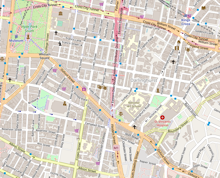
@jroper Have you worked with OpenStreetMap data? I find it much more enjoyable for "exploring" than Google Maps.
@jakecoppinger I do a ton of my research with it - but I've surprisingly not used it much personally. Now I'm looking at the same area for comparison, I like the more even-handed approach to what to show - like how it shows many icons for points of interest when you zoom in, even though only labelling a few, for space. The current Google Maps interface doesn't give the same impression of intensity of use, apart from the faint yellow areas.

Google's is very commercial - mostly pubs and cafés apart from the Jewish Museum. (Does Google think I'm very interested in pubs, or is that what people are usually looking for in Surry Hills?) The NAS is a blank gray space, suggesting nothing interesting, until you zoom in closely and it gains a small label.
How much does ubiquitous use of one mapping system influence how we understand the city and what possibilities we see in it?
(Maybe not much for people less into maps than me!)