
Trufi Association @trufiassoc@transportation.social
We help transform mobility in cities with open source apps, and open data solutions that enable innovation.
T: TrufiAssoc
Joined Jan 2023
Are you a MaaS innovator? 📊 Trufi Association is your indispensable partner for GTFS and integration into apps, analytics, and transport tech solutions. Join us in revolutionizing transport for the global South and North!
#informaltransport #opendata #opensource #publictransport #sustainabletransport #transportation #ict4d #ict4dev #MaaS #MobilityAsAService #publictransit #mapping #Multimodality #mobility #populartransport #OpenStreetMap #GTFS
Wrangling transportation data in the global South is no easy feat. It's our specialty. We harness community crowdsourcing and OpenStreetMap to provide accurate GTFS informed by the people who know the city better than anyone.
#bus #digital #digitaldevelopment #ict4d #ict4dev #informaltransport #MaaS #mapping #Mobility #multimodal #Multimodality #opendata #opensource #opensteetmap #publictransit #publictransport #PublicTransportation #sustainabletransport
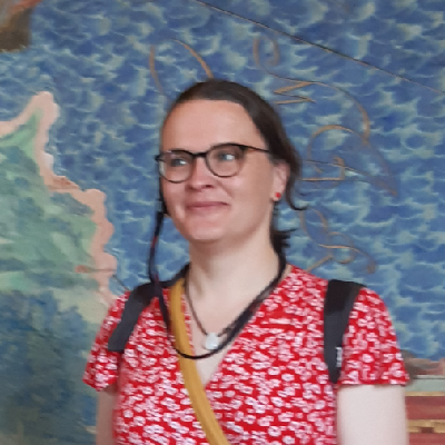
@Nathanpboston "Car violence" is a tautology.
Trufi Association
boosted
What does “OSM” stand for?
wrong answers only 😈
#OpenStreetMap
(with hat tip to the OSM World Discord Server <https://discord.gg/openstreetmap> for the idea)
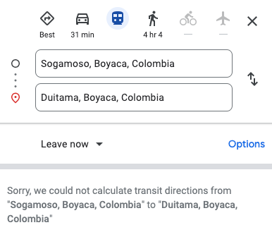
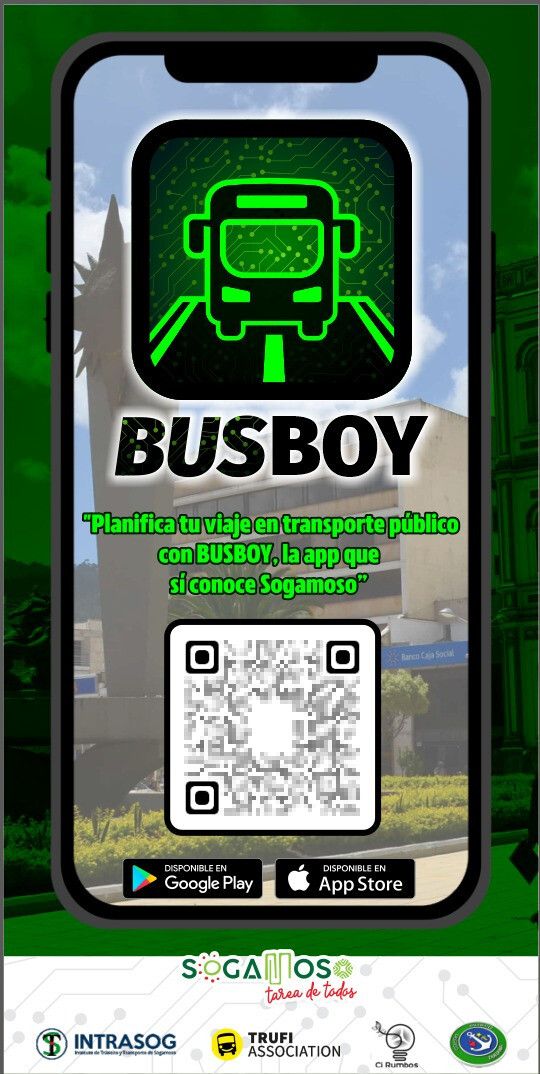
Hmmm... Duitama and Sogoamoso are only 20 km apart, but Google can't route you from one city to the other on public transport? BusBoy can.
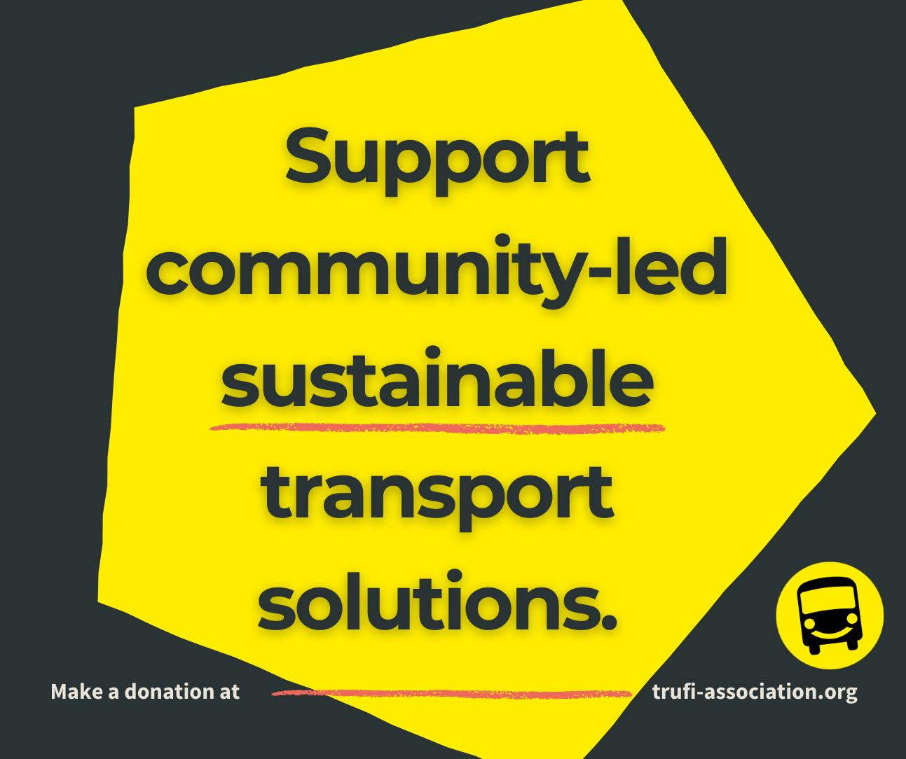
Open Source. Open Data. Better Cities. Help us shape urban mobility with one-time or a recurring donation to Trufi Association
#digitaldevelopment #ict4d #ict4dev #informaltransport #innovation #MaaS #mapping #Mobility #morningcommute #multimodal #Multimodality #opendata #opensource #opensourcesoftware #opensteetmap #OpenTripPlanner #publictransit #publictransport #PublicTransportation #software #sustainabletransport #tech #technology #transportation #donate
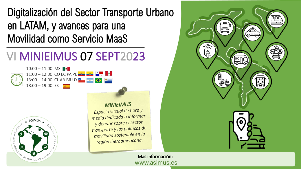
"Avances en la digitalización del transporte urbano en LATAM y la Movilidad como Servicio (MaaS).
"MINIEIMUS": Espacio virtual de 1.5 horas para informar y debatir sobre transporte y políticas de movilidad sostenible en Iberoamérica, con Leonardo Gutiérrez de Trufi Association.
Regístrate y obtén más información: https://www.asimus.es
#Argentina #Brasil #Chile #Colombia #Ecuador #España #México #Panamá #Perú #Uruguay #MaaS #TransporteInformal #LATAM
You didn't know that Trufi does chatbots, did you? From journey planning to public safety reporting to transport research data collection.
#Technology #Chatbots #InformalTransport #AI #Research #publictransport #publictransportation #transportation
Researchers: Seeking mobility insights that are hard to come by? Look No Further! 🔍 Trufi research services bridge the gap between research designers and local communities in global South cities. By tapping into local knowledge through engagement with OpenStreetMap communities, we ensure research aligns with real-world experiences. 🌍🚌
#UrbanMobility #ResearchForChange #InformalTransport #Research #PublicTransport
@luc Public transport around the world is largely unmeasured. We only know it's a huge source of emissions. Decarbonizing transport can't be planned well if we don't know what is there.
Also: There are developments in the GTFS standard that will ultimately be able to provide real-time location data for transport, and make journey planner apps more usable (where transport agencies provide real-time data.)
@luc Imagine if your city did not have well-mapped public transport. That is the case for most cities of the world, especially the global South.
OSM data can be transformed into GTFS data - essential for people who study, manage and/or transport networks in cities of all sizes: City planners, transport managers, researchers, MaaS innovators. With accurate GTFS, user apps can be deployed, and informal transport becomes more usable, reducing car dependency. Cities can estimate carbon emissions.
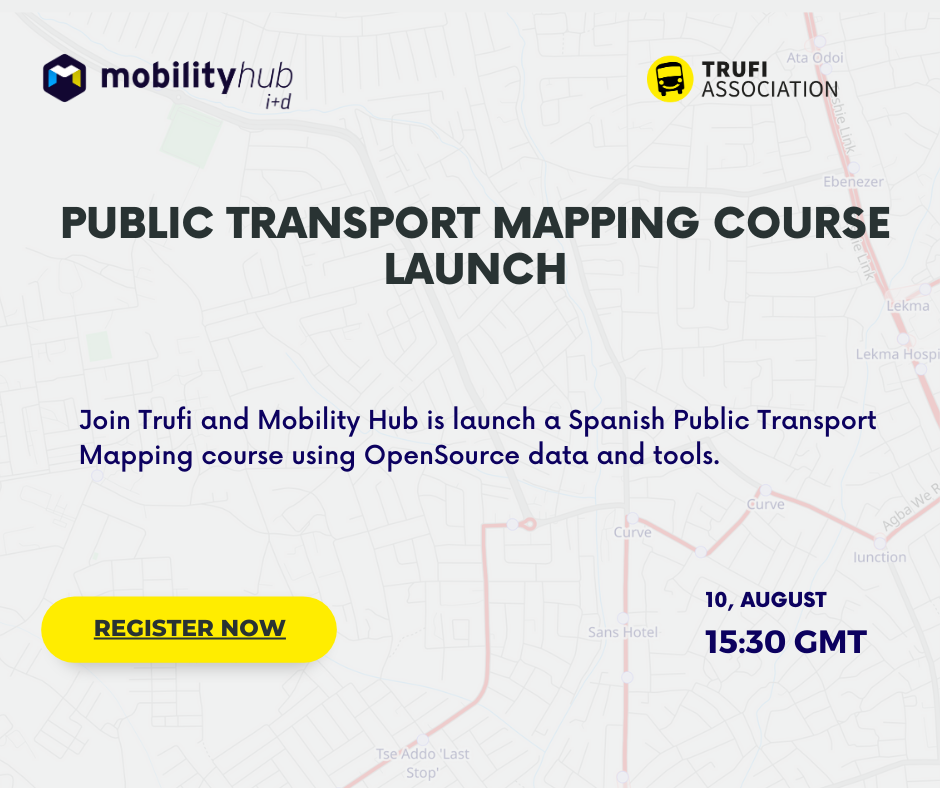
Game-changer! One of the most impactful things an OpenStreetMapper can do is to map public transport. A new mapping course launched by Trufi Association and Mobility Hub - Colombia has the potential to revolutionize transportation planning with community-driven solutions. 🚌🌍 Available in Spanish. English coming soon.
@hotosm
#informaltransport #publictransport #openstreetmap #opendata #espanol
What the global South can learn from #Germany's #Deutschlandticket while avoiding the pitfalls of imitating the global North (a.k.a. #transportation colonialism), 🚌🌍 Spoiler: Germany broke the habit of imitating itself.
Attn: @benjiedlp
#InformalTransport #populartransport #sustainabletransport
https://tinyurl.com/24mw6jg7
Uncover the intersection of gender, safety, and digital innovation in informal transport. Pauline Baudens explores the unique challenges women face during commutes in the global South. Join the conversation on building inclusive transportation solutions.
#GenderMobility #SafeJourneys #InformalTransport #genderequality #gender #video
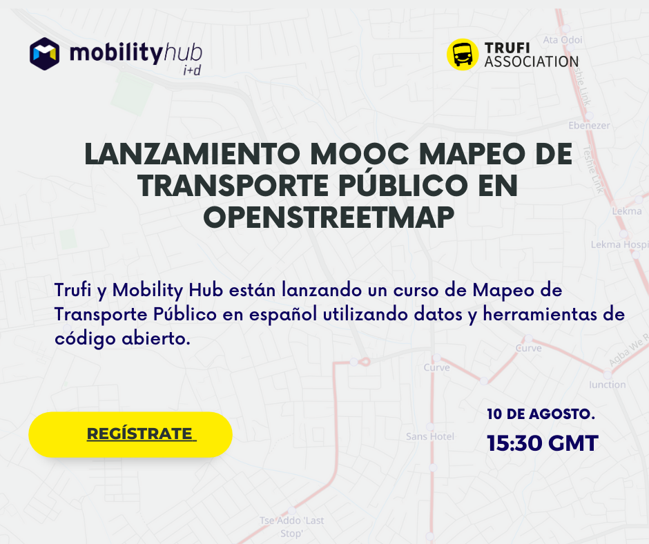
EN VIVO AHORA: Lanzamiento del MOOC de Mapeo de Transporte Público en #OpenStreetMap
https://www.linkedin.com/events/lanzamientodelmoocdemapeodetran7091825629364383744/theater/
Evento de Lanzamiento HOY: Un Curso en Línea Abierto y Masivo para Mapear el #TransportePúblico en #OpenStreetMap (#EnEspañol). Trufi se ha asociado con Mobility Hub para ayudar a capacitar a los mejores mapeadores que impulsan #opendata para el #transporteinformal
https://www.linkedin.com/events/lanzamientodelmoocdemapeodetran7091825629364383744/theater/
Launch Event TODAY: A Massive Open Online Course for Mapping #PublicTransport in #OpenStreetMap (Spanish #EnEspañol). Trufi has partnered w Mobility hub to help train the best mappers that power #opendata for #informaltransport
https://www.linkedin.com/events/lanzamientodelmoocdemapeodetran7091825629364383744/theater/
We help transform mobility in cities with open source apps, and open data solutions that enable innovation.
T: TrufiAssoc
Joined Jan 2023