Josephine Roper @jroper@transportation.social
- Home page
- https://josephineroper.com/
- Research Gate
- https://www.researchgate.net/profile/Josephine-Roper
- Open source walkability index
- https://github.com/JosephineRoper/THERE
- Climbing by sustainable transport blog
- https://carlesscragging.wordpress.com/
PhD student at UNSW City Futures Research Centre. Committee member of WalkSydney (https://walksydney.org/). Interested in access, walkability, sustainable transport in general, open source urban analytics. Transport cyclist, climber, plant based.
Joined Dec 2022
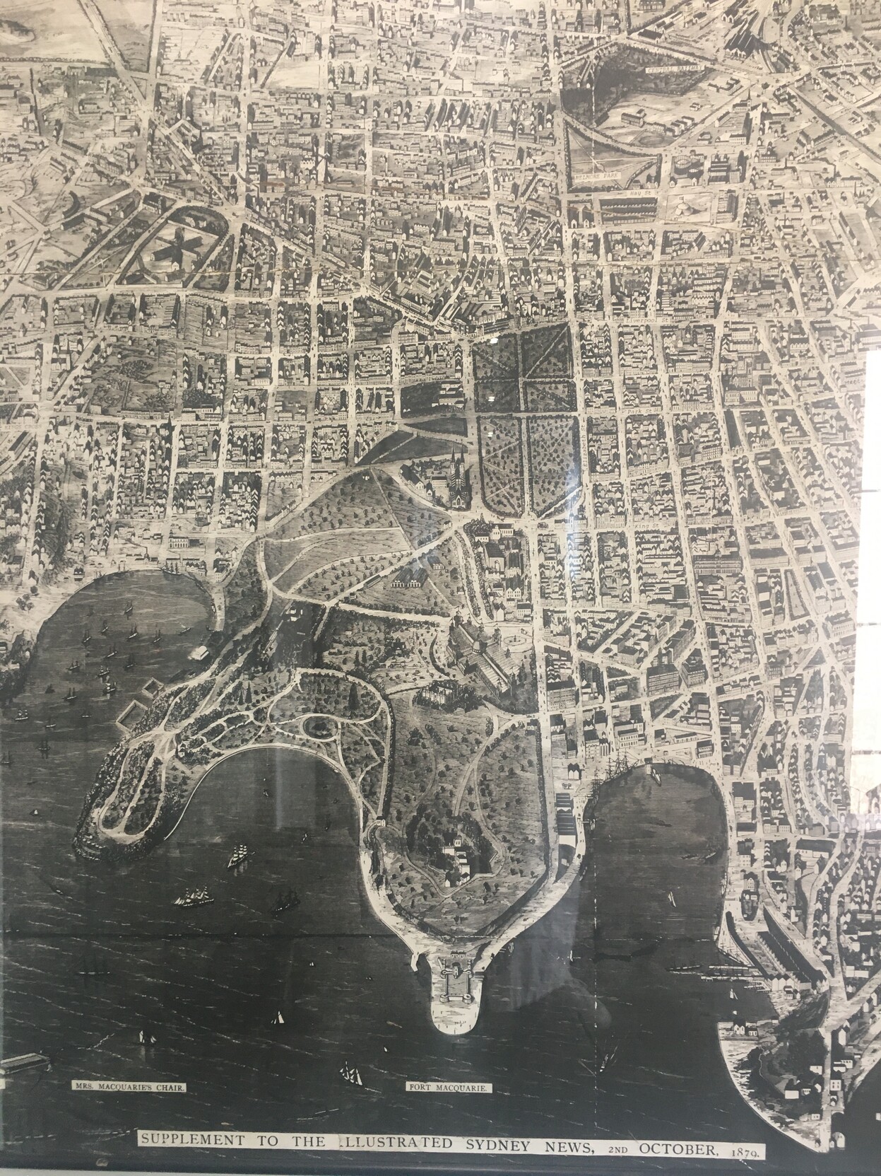
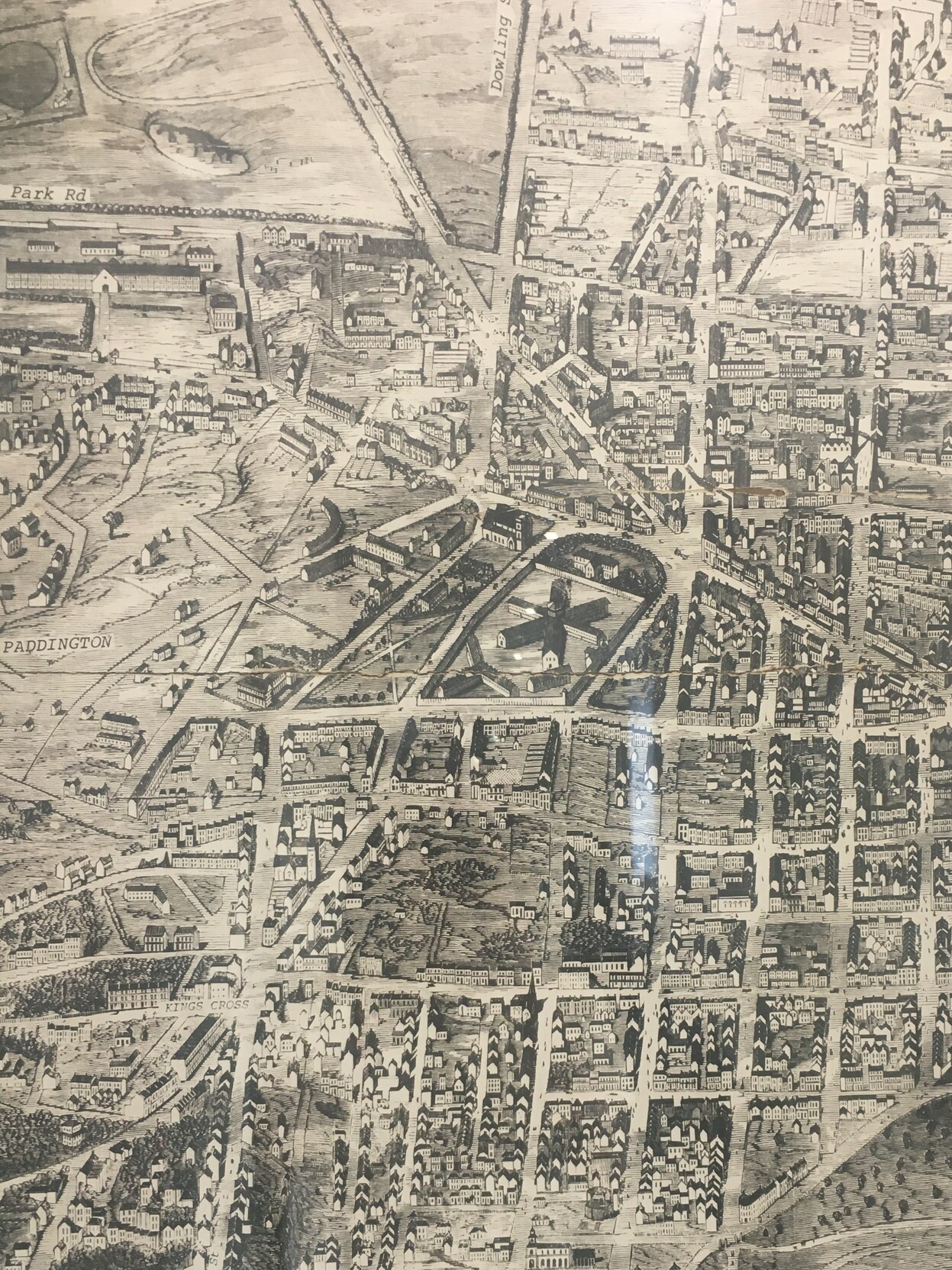
Another map of Sydney with another view of the National Art School. This 1879 'Supplement to the Illustrated Sydney News' hangs upstairs in UNSW's Old Main Building. It's almost 2m tall and it needs to be, with the level of detail shown.
(Went on a campus walk with the People & Place cluster, checking out UNSW's oldest buildings - that is to say, from the 1950s - and many pieces of art I'd never stopped to look at before.)
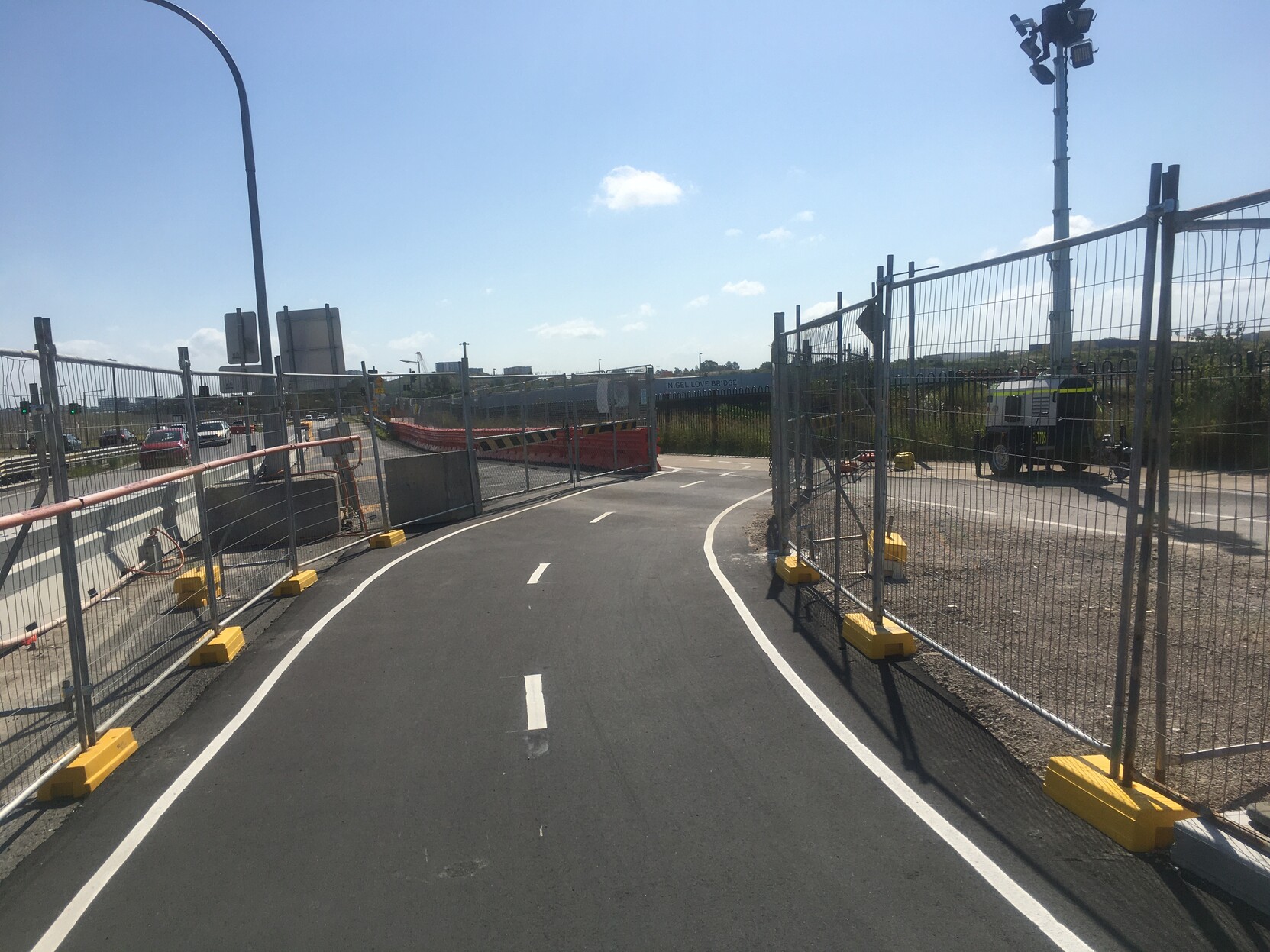
Rode to Earlwood for some solo climbing yesterday as am testing + but no symptoms. Nice to see the effort put into maintaining the bike path through Sydney Gateway construction. And the new path on the other side of the canal (new to me anyway) is great. Just that bit further from the road.
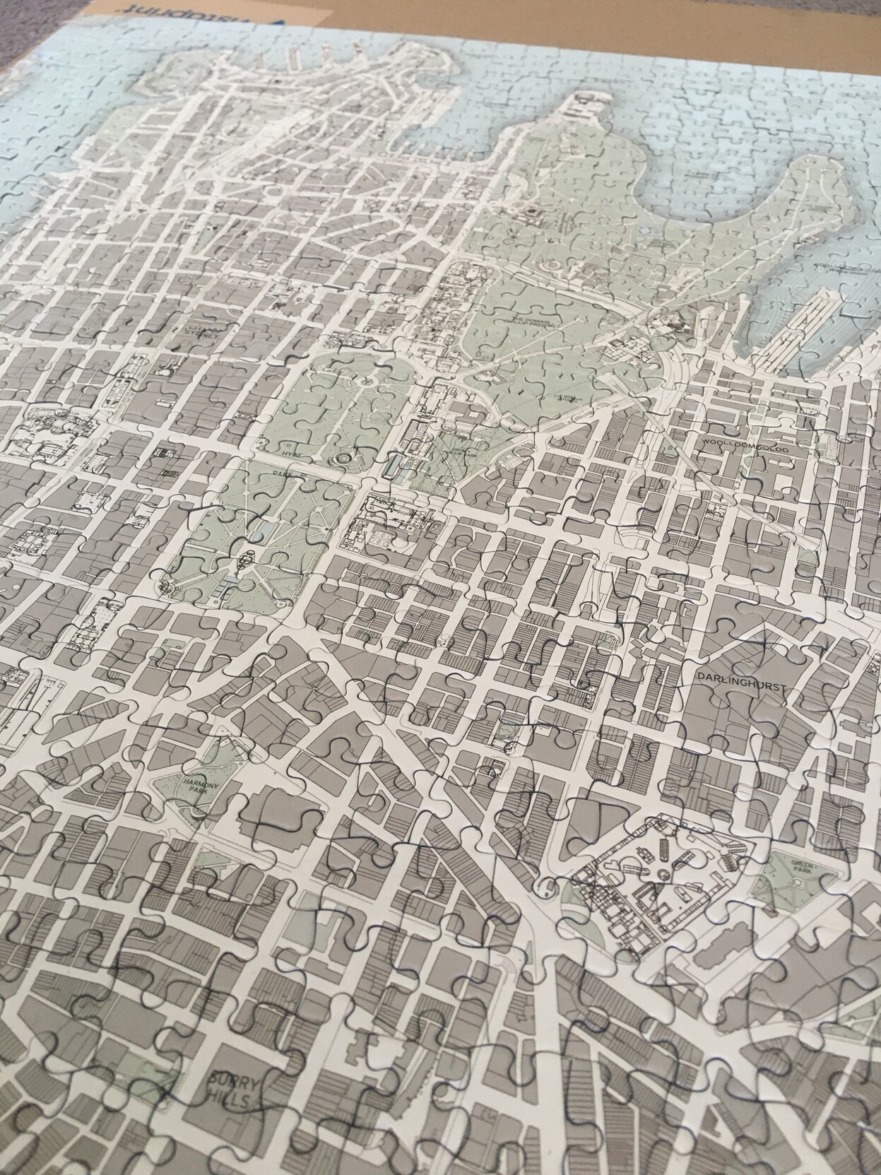
Oh yeah, this is what it looks like as a puzzle (used the box picture for clarity before). Now I've got to work out what to do with it.
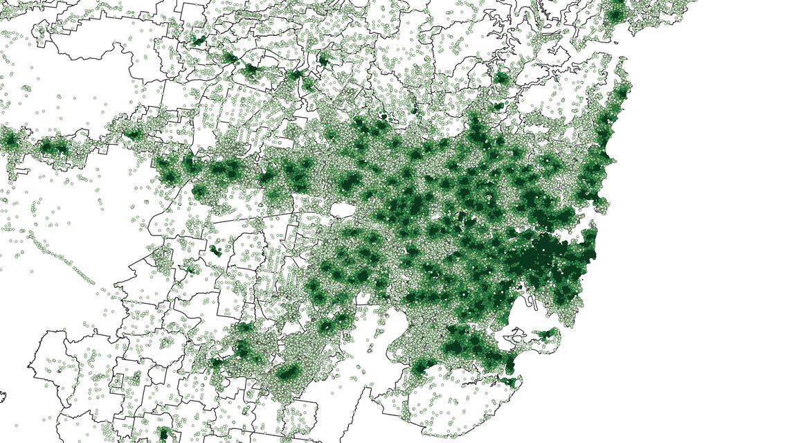
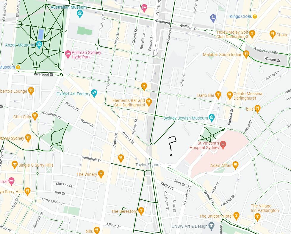
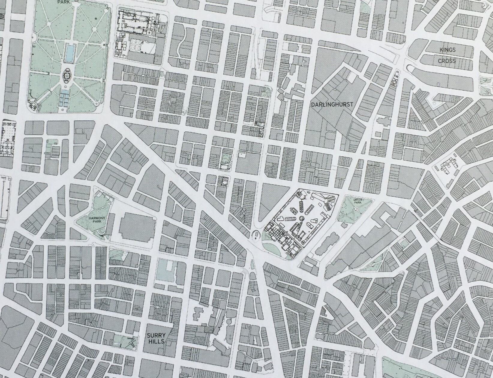
Darlinghurst mapped: Google vs Public Sydney
Spent a few too many hours since Christmas doing my Public Sydney puzzle the slow way - without looking at the picture or other maps to help!
The complex in the middle here puzzled me - I had no idea what or where it was. Turns out it's the National Art School, in the marvellous historic buildings of one of our oldest prisons: https://nas.edu.au/history/
Anyway, it really brought home the different perceptions of a city via different maps (cont)
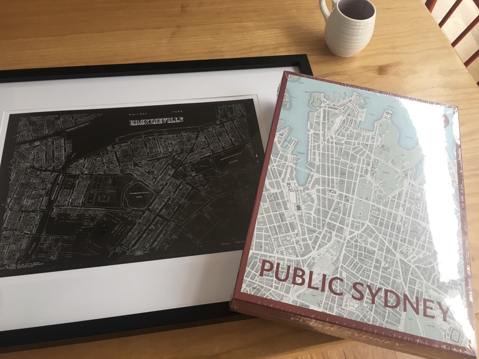
Christmas presents! My people know me ❤️
Though I did send some of them a link to @philipthalis’s puzzle in advance… gotta drop hints 😁
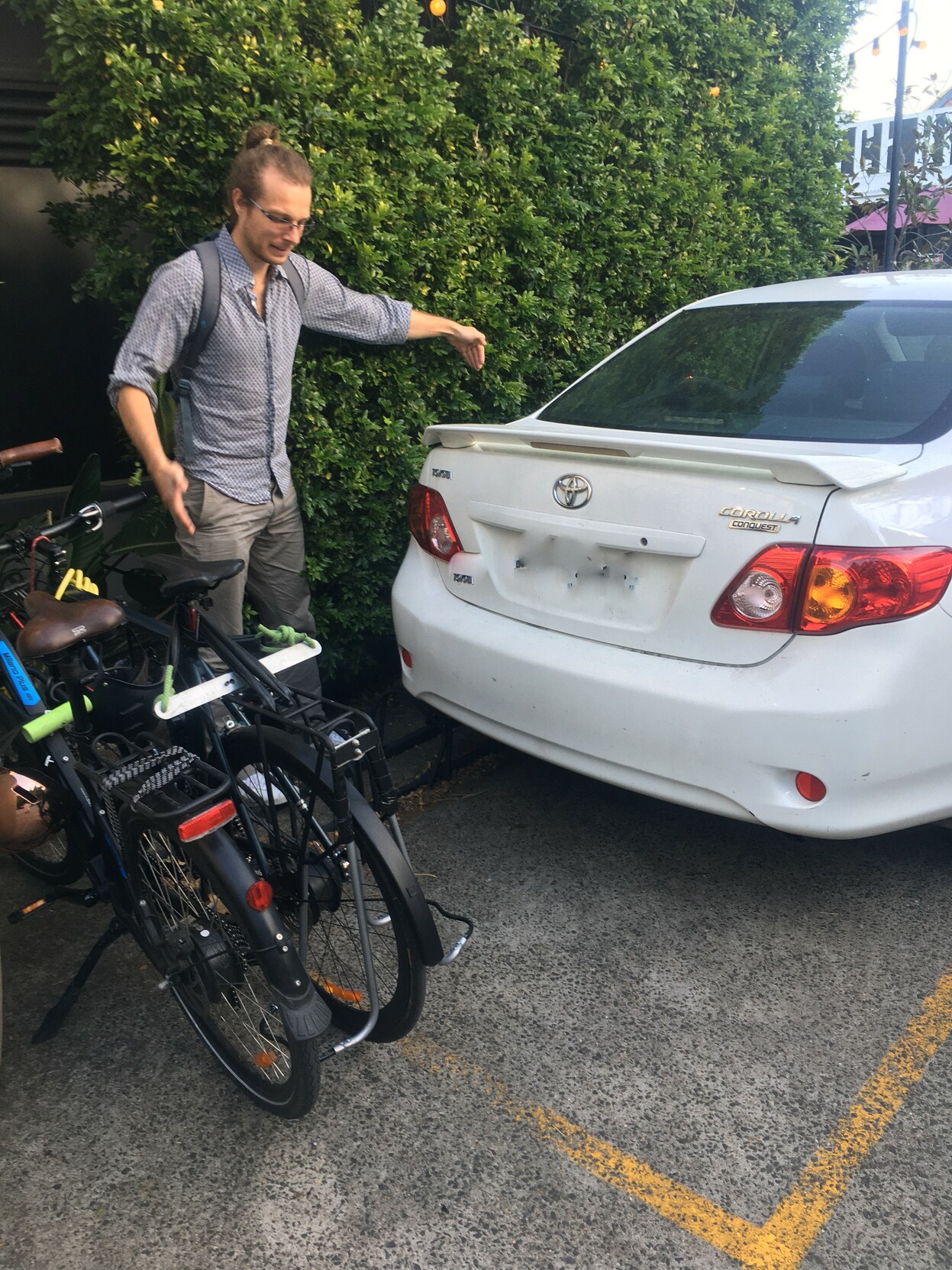
Bike parking at the pub! ... as long as you get there before this person 🙃
(In their defense, the rack was already bent, and the yellow paint is quite ambiguous as to what is meant to be going on)
- Home page
- https://josephineroper.com/
- Research Gate
- https://www.researchgate.net/profile/Josephine-Roper
- Open source walkability index
- https://github.com/JosephineRoper/THERE
- Climbing by sustainable transport blog
- https://carlesscragging.wordpress.com/
PhD student at UNSW City Futures Research Centre. Committee member of WalkSydney (https://walksydney.org/). Interested in access, walkability, sustainable transport in general, open source urban analytics. Transport cyclist, climber, plant based.
Joined Dec 2022