Josephine Roper @jroper@transportation.social
- Home page
- https://josephineroper.com/
- Research Gate
- https://www.researchgate.net/profile/Josephine-Roper
- Open source walkability index
- https://github.com/JosephineRoper/THERE
- Climbing by sustainable transport blog
- https://carlesscragging.wordpress.com/
PhD student at UNSW City Futures Research Centre. Committee member of WalkSydney (https://walksydney.org/). Interested in access, walkability, sustainable transport in general, open source urban analytics. Transport cyclist, climber, plant based.
Joined Dec 2022
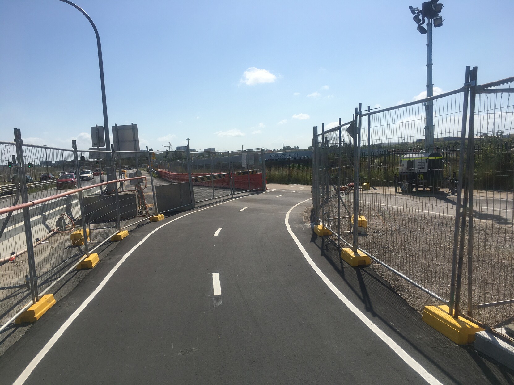
Rode to Earlwood for some solo climbing yesterday as am testing + but no symptoms. Nice to see the effort put into maintaining the bike path through Sydney Gateway construction. And the new path on the other side of the canal (new to me anyway) is great. Just that bit further from the road.
github copilot works with R way better than expected, for a language that isn't mentioned as supported 😯
Going to enjoy my two months of rapid coding (before getting turned into paperclips or free trial expires, whatever comes first)
Had a dream about how skilifts are a really energy-efficient form of transport because they don't move much more than a person's body and a little metal, so they're more like a bike than a car. Now I'm trying to find out if this is actually true or not...
and wishing if my brain wants to work on sustainable transport overnight, it would pick a more useful topic 😅
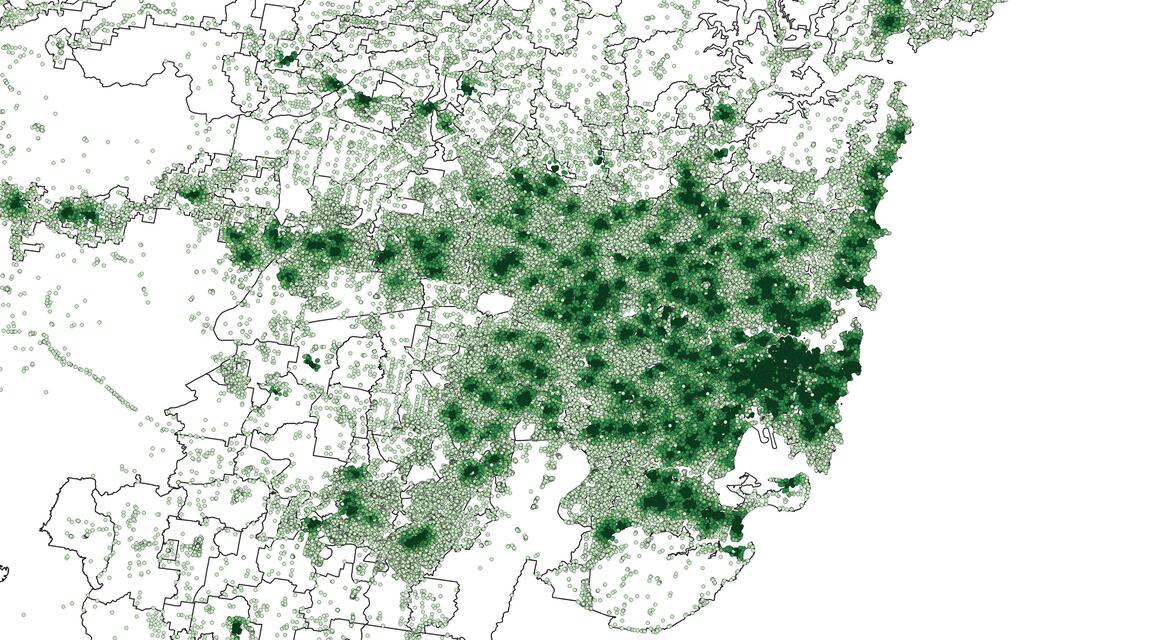
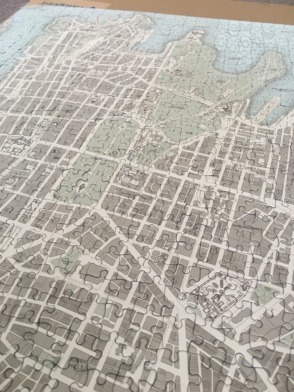
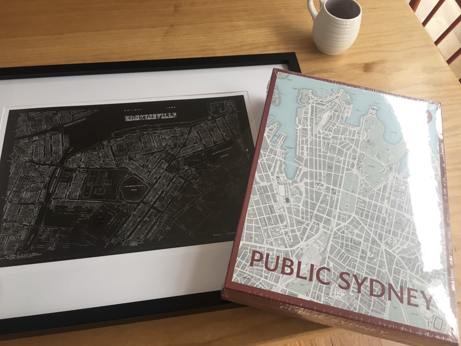
Oh yeah, this is what it looks like as a puzzle (used the box picture for clarity before). Now I've got to work out what to do with it.
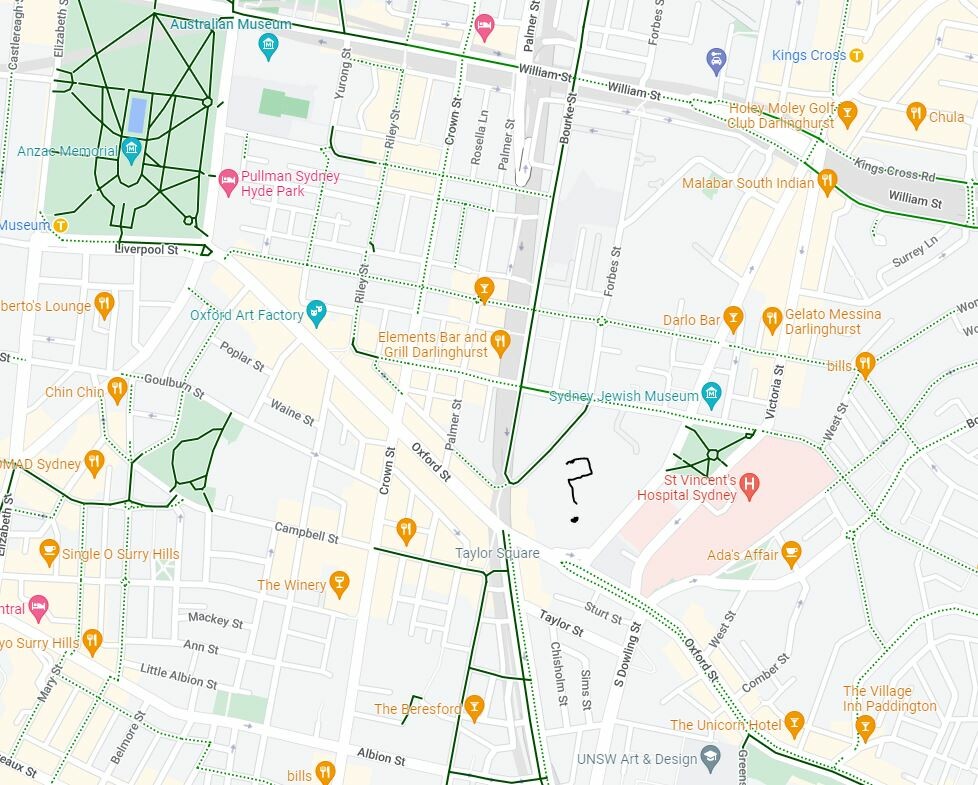
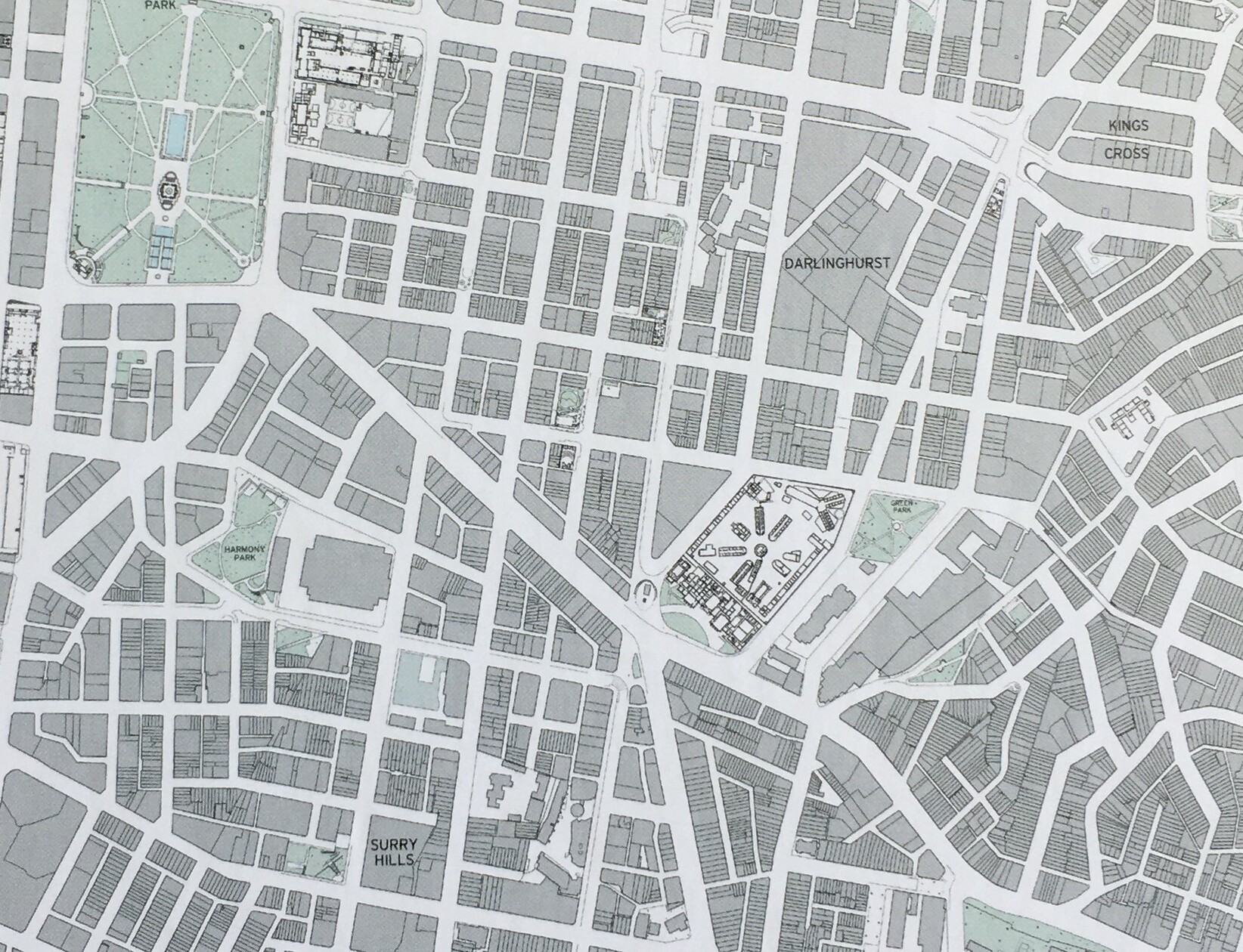
Google's is very commercial - mostly pubs and cafés apart from the Jewish Museum. (Does Google think I'm very interested in pubs, or is that what people are usually looking for in Surry Hills?) The NAS is a blank gray space, suggesting nothing interesting, until you zoom in closely and it gains a small label.
How much does ubiquitous use of one mapping system influence how we understand the city and what possibilities we see in it?
(Maybe not much for people less into maps than me!)
Darlinghurst mapped: Google vs Public Sydney
Spent a few too many hours since Christmas doing my Public Sydney puzzle the slow way - without looking at the picture or other maps to help!
The complex in the middle here puzzled me - I had no idea what or where it was. Turns out it's the National Art School, in the marvellous historic buildings of one of our oldest prisons: https://nas.edu.au/history/
Anyway, it really brought home the different perceptions of a city via different maps (cont)
@vallery Also I'm really interested in how they will be programmed to treat cyclists, but I imagine it will be respectful: this is another valid road user I will only overtake if it is safe to do so. Could actually lead to feeling much safer cycling in cities like mine, where many drivers seem angry and stressed at the sight of a bicycle.
Christmas presents! My people know me ❤️
Though I did send some of them a link to @philipthalis’s puzzle in advance… gotta drop hints 😁
Josephine Roper
boosted

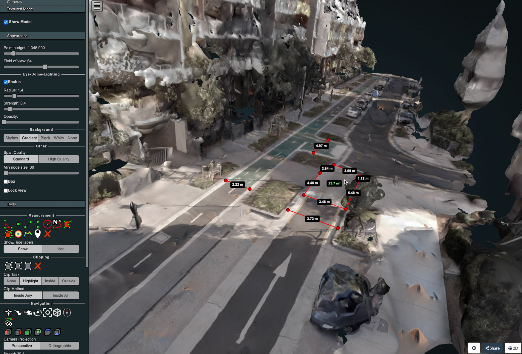
I wrote a technical guide showing how you can create your own orthorectified (aka satellite view/bird mode) imagery, point clouds and 3D models of streets with nothing but a 360 degree camera mounted on bicycle helmet, and the open source photogrammetry software OpenDroneMap.
Why might you want to do this? With your own up-to-date, highly detailed point clouds and imagery you could:
- quantify and communicate inefficient road space allocation
- record necessary infrastructure repairs
- take measurements such as lane and cycleway widths
- measure footpath obstructions in 3D and rate pedestrian amenity
- map kerb features on OpenStreetMap
- survey street parking using the new OSM spec: https://wiki.openstreetmap.org/wiki/Street_parking
- 3D print a model of your home street!
#openstreetmap #opendronemap #maps #photogrammetry #curb #kerb #parking #cycling #urbanism #mapping
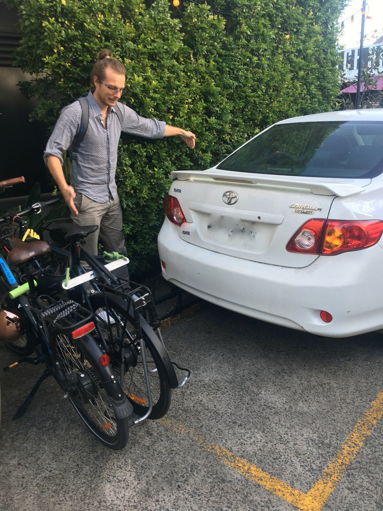
Bike parking at the pub! ... as long as you get there before this person 🙃
(In their defense, the rack was already bent, and the yellow paint is quite ambiguous as to what is meant to be going on)
Josephine Roper
boosted
Did you know? We have a list of our favorite books for kids. Radicalize 'em into The War on Cars young... that's our philosophy.
Perfect gifts for the holidays!
the irony that this is now my most boosted post, is not lost on me
Handy Mastodon feature I noticed today, other newbies might find useful: you can go to someone's profile and "hide boosts" from them (click on the three dots right of Follow).
Ie, if you want to keep following someone's own toots but think they boost too much random stuff.
Josephine Roper
boosted
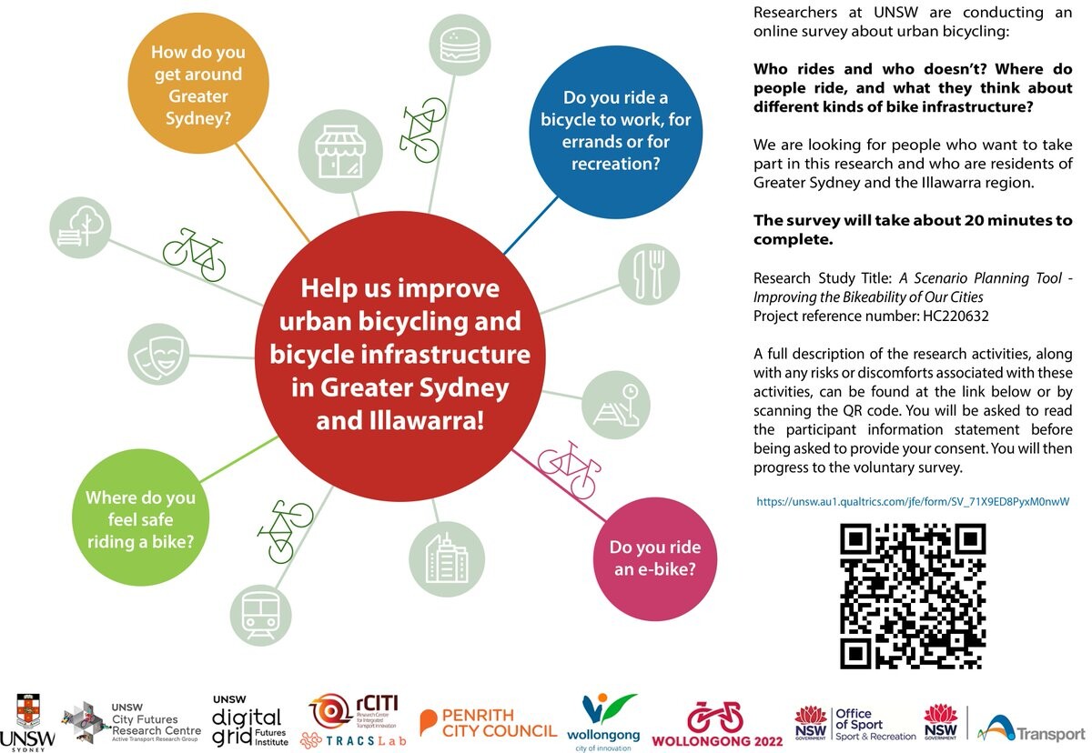
https://twitter.com/FrankWu2316/status/1600284783950827521?s=20
RT @FrankWu2316@twitter.com
Ride a bike in Sydney? Take our cycling survey here....
🐦🔗: https://twitter.com/FrankWu2316/status/1600284783950827521
Dropped a mention of @walk_sydney in there :) Suggested looking them up in response to many callers concerned about safety and lack of footpaths in their local areas, who don't necessarily know where to start with raising these issues.
will be on the radio tomorrow morning talking about research (walkability). Just a bit terrified 😬
Telling myself the only people listening to the ABC at 10am are old and chill, so I can just imagine I'm explaining my work to my grandpa. Any other tips for good radio chats are welcome!
Will be speaking on #walkability at our unit seminar (open to all) next Friday 4pm AEDT.
Have done the thing where I set myself a rather broad abstract for a 10 minute talk... Wanted to try something new in terms of bringing people on board, rather than the usual 'here is everything I've done in my PhD to date' talk that I've given before.
https://www.eventbrite.com.au/e/cfrc-seminar-series-friday-9th-december-2022-tickets-428935095417
Think I did the server move wrong and lost everyone I followed... woops. Well, happy to be on transportation.social now
- Home page
- https://josephineroper.com/
- Research Gate
- https://www.researchgate.net/profile/Josephine-Roper
- Open source walkability index
- https://github.com/JosephineRoper/THERE
- Climbing by sustainable transport blog
- https://carlesscragging.wordpress.com/
PhD student at UNSW City Futures Research Centre. Committee member of WalkSydney (https://walksydney.org/). Interested in access, walkability, sustainable transport in general, open source urban analytics. Transport cyclist, climber, plant based.
Joined Dec 2022